Description
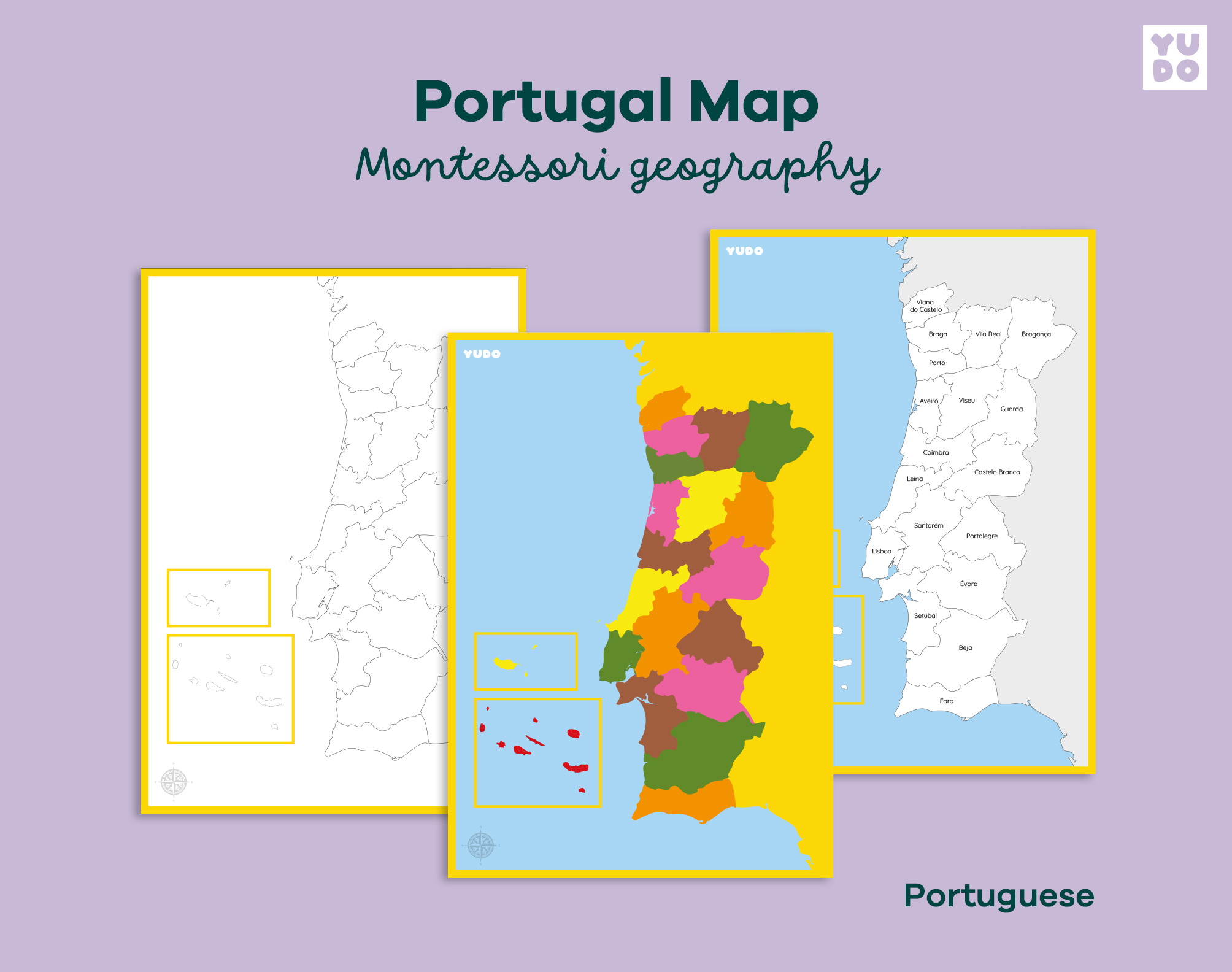
This Montessori Portugal Map helps children learn and identify the districts of Portugal through hands-on geography work. Designed to support visual learning and independent exploration, this printable map introduces national geography in a clear and structured way.
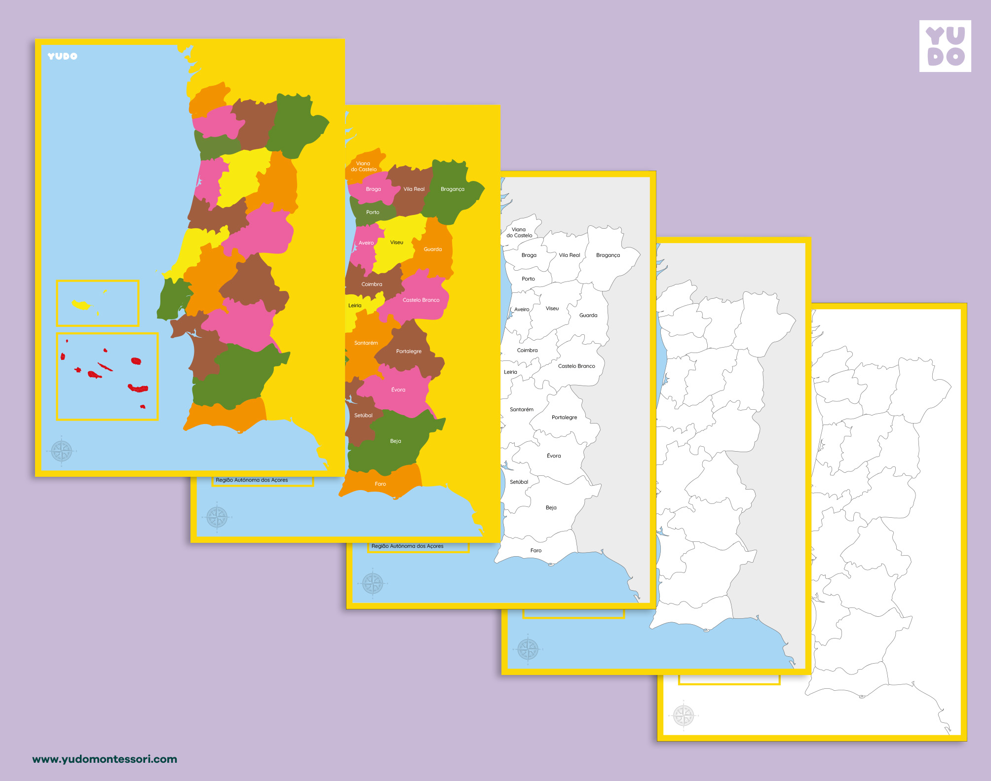
The map features all 18 districts of mainland Portugal plus the autonomous regions of Madeira and the Azores, aligned with the traditional Montessori geography colors to aid recognition and memory.
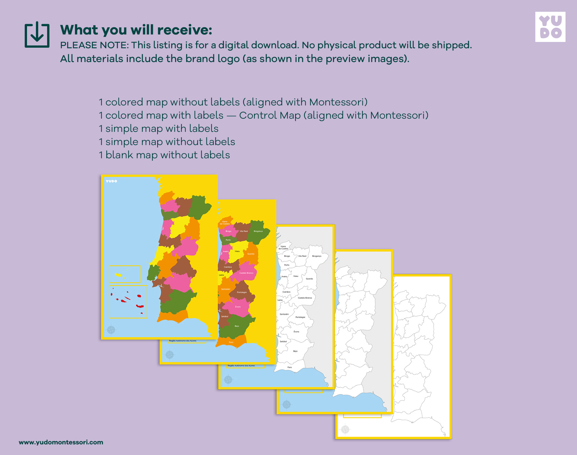
What is included in your Portugal Map set:
After purchase, you will be able to download a high-quality PDF file (A4 size) including:
Colored Map with Labels: A full-color version featuring the names of all districts and regions in Portuguese.
Colored Map without Labels: A full-color version without text, ideal for visual recognition.
White Map with Colored Background (with Labels): A version where the map of Portugal is white, but the surrounding areas are colored, including all district names.
White Map with Colored Background (without Labels): A version with a white map and colored background, without any text for testing knowledge.
Outline Map: A simple black and white outlined version, perfect for coloring, labeling, and independent map-making activities.
Note: This is a digital product. No physical items will be shipped.
This map can be used in conjunction with our Portugal Districts Cards for a complete study experience and is designed to be the perfect extension for the Montessori wooden puzzle map.

Reviews
There are no reviews yet.